Formation of a volcanic island: Mauritius

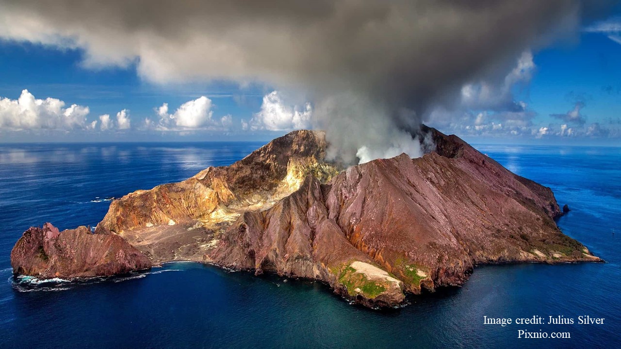
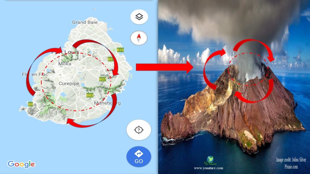
The island of Mauritius was formed approximately 10 million years ago by volcanic eruption. In fact, the island itself is a volcano. The highest point, 550 m – 600 m above sea level, is the central plateau; from there on, the land gently slopes towards the sea. The Port Louis – Moka Range, Black River Range and Savanne Range are the bits left of the original caldera of the shield volcano that gave birth to the island of Mauritius.

Formation of volcanic islands
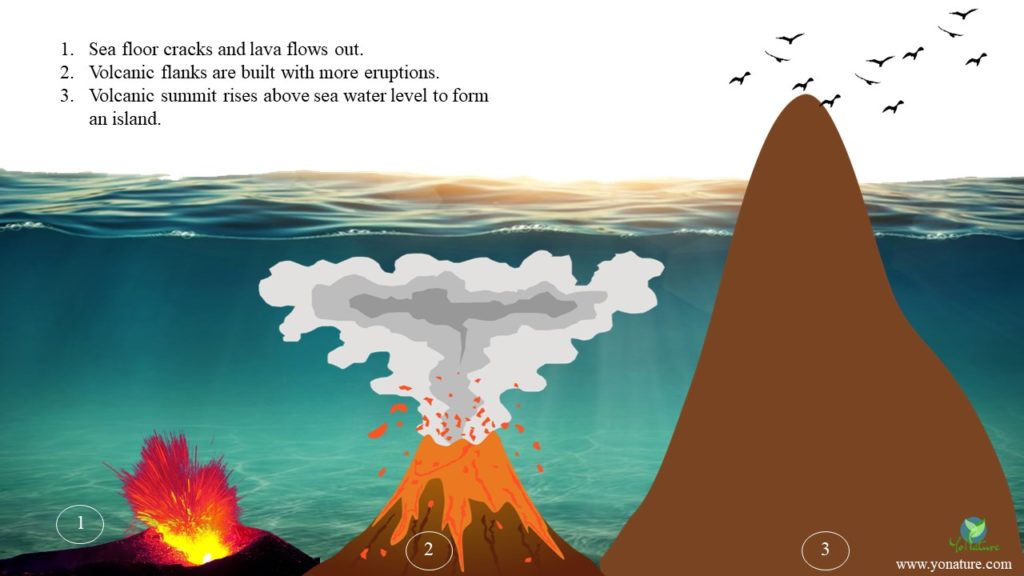
The question is, can a volcano actually erupt under water? While we are mostly used to terrestrial volcanic eruptions that release lava and smoke that we can see, undersea volcanic eruptions are also quite common though less visible. So, yes, volcanoes do erupt underwater. The principle is the same as the volcanoes on land except that, in these cases, they are on the seafloor.
Just like any other volcano, pressure builds up under the ocean floor which eventually causes the floor to crack and magma to burst out. In contact with seawater, the lava cools quite rapidly depending on its geochemistry and the temperature of the surroundings. The outer layer directly in contact with seawater cools to form glassy rocks within minutes but the inner layers take months to years to actually solidify. Supplementary eruptions from the main volcanic vent or from fissures along the flanks of the rocky dome gradually build it up until it pokes its nose out of the sea. In this way, a volcanic island is formed.

Formation of Mauritius Island
There is some debate as to the actual formation of Mauritius. While some scientists are in favour of the hotspot theory that created the Mascarene island groups, others support the independent formation of the Mascarene islands by fracture zones on the sea floor.
But, basically, the initial genesis of the island remains the same. Everything started 65 million years ago, during the breakup of Gondwana when India detached from Africa and moved upwards towards Asia. Flood basalts erupted along the volcanic hot spot where Reunion is now located as India crashed into Asia forming the Himalayas mountains.
It is at this point that ideas diverge.
1. Hotspot theory
A hotspot is a region in the mantle where magma rises to the surface. As it pushes through the crust, it initiates the formation of volcanoes. Since the crust is constantly in movement, the volcano created slides over the magmatic chamber, becomes inactive and can form an island. Another volcano is created in its place until the hotspot’s activities decrease.
It is believed that to the east of Reunion, there is a volcanic hotspot that gave rise to the Mascarene Islands, the Chagos-Maldives Laccadive Islands, the Saya de Malha and the Nazareth Banks.
Reunion island itself started to form some 60 million years ago from an isolated volcano on an oceanic crust 3000 m deep [1]. The island emerged 3 million years ago and volcanic activity has been continuous on Piton de la Fournaise.
Based on stratigraphic and potassium-argon dating, Mauritius emerged from this volcanic hotspot 10 million years ago; the volcano remained active until 25,000 years ago.
2. Fracture zone theory
The seafloor in the west Indian Ocean is undulated by fracture zones emerging from the mid-Indian ocean ridge. It is suggested that these fracture zones spewed up magma independently forming the Mascarene Islands. The main fissure was still active some 10 million years ago forming the initial volcanic shield of Mauritius and gradually building it up until its activity decreased.
Rodrigues, too, is suggested to have been formed by activities in the Rodrigues fault as the ridge adjusted its position over the years [1]. Studies suggest that actually volcanic activities started approximately 10 million years ago forming a flat base mount. This mount eventually eroded forming a plateau upon which the Rodrigues steep sided volcano emerged 2.5 million years ago [2].
So, finally how was Mauritius formed?
While in general both theories seem plausible, there are also several factors that have to be taken into consideration:
- Rate and direction of the African and Somali plates 65 million years ago
- Path taken by Madagascar and India during the break up of Gondwana
- Age of the lava flows on the different islands
I, for one, personally believe in the fracture zone theory for the formation of Mauritius. In the light of new data recently found, the lost continent under Mauritius, it is unlikely that the island groups have been formed by hot pot activity. To be sure, the formation of the Hawaii Islands presents a good case for hotspot volcanism, but this is not reflected in the Mascarene Islands’ scenario.
Geological chronology[1]
Volcanic islands do not form overnight; they take millions of years to appear and harden and even more years to become habitable. The different stages in the formation of Mauritius and the different types of rocks present then are discussed below.
1. The Breccia Series
This is the time period when the island emerged about 10-7.8 million years ago. The mound of land was circular in shape with a diameter of 40 km. Its altitude was relatively low, reaching only 300 m at Montagne Longue, Grand and Petit Malabar, Pailles Hill and Seneque Hill. During this epoch, the island consisted of layers of coloured tuff, volcanic ash, alkali basalt and oceanites.
2. The Old Lava Series
7.6-5 million years ago, a proper volcano 40 km wide was in process with a shield and a centre at Montagne La Terre and a maximum height of 900 m. The volcano had basalt 5 m – 30 m thick and agglomerates; the lava composed of picrate basalt, olivine basalt and hawaites.
Most of the old lava has been eroded except for the Port Louis – Moka Range, the Bamboo Range, the Black River Range, Montagne Blanche, Montagne Fayence, Le Morne Brabant and Corps de Garde. The closing phase of the old lava series produced basalt rich in feldspars and andesites. 5 million years ago, the downward movement of the central dome collapsed to form smaller mounds at Piton du Milieu, Montagne Camizard, Montagne La Selle, the plug near Verdun and the road between Case Noyale and Chamarel.
After this period, there a was a calm stage during which precipitation in the form of rain carved beautiful valleys and gorges.
3. The Early Lava Series
Volcanic activity resumed 3.5 million years ago along fissures and vents on the land mass releasing olivine basalts. This helped in forming the wide agglomerate beds at Mare aux Vacoas and in the south-west of the island.
Again, volcanism ceased for 1 million years giving way to another erosional period.
4. The Recent Lava Series
The last volcanic activities took place 700,000 years ago spewing out olivine basalts from around 25 vents. This helped in shaping the upper lands as well as the coastal plains. These vents are now seen as low cones some with distinct craters, others as water-filled pits.
The last volcanic eruption in Mauritius took place only 25,000 years ago from the L’Escalier Crater at Nouvelle Decouverte forming the Plaines des Roches!
Reference:
- Saddul, P. (2002). Mauritius, A Geomorphological Analysis. Moka, Mauritius: MGI, pp 25, 31-34
- Middleton, G. and Burney, D.A. (2013). Rodrigues – An Indian Ocean island calcarenite: Its history, study and management. ResearchGate: Coastal Karst Landforms, pp 261-276 [Online] Available at https://www.researchgate.net/publica tion/291197111_Rodrigues_-_An_Indian_Ocean_Island_Calcarenite_Its_History_Study_and_Management [Accessed 20 Nov 2018]

Pingback: Rainwater harvesting – saving water in Mauritius - Yo Nature
Pingback: Volcanic Eruptions: Positive and Negative Effects - Yo Nature
Pingback: Wildfires Explained: Types, Causes and Examples - Yo Nature
Pingback: Flooding Explained: Types, Causes and Examples - Yo Nature
Pingback: Moringa oleifera (Brede Mouroum), The Magical Tree - Yo Nature
Pingback: COVID-19 in Mauritius – A success Story? - Yo Nature
Pingback: Landslides Explained: Types, Causes and Examples - Yo Nature
Pingback: How Mauritius, a Small Island Developing State, is adapting to sea level rise - Yo Nature
Pingback: Earthquakes Explained: Types, Causes and Examples - Yo Nature
Pingback: Sea level rise Mauritius: Relocation as a prospective solution - Yo Nature
Pingback: Climate change: Natural and Anthropogenic causes - Yo Nature
Pingback: Offshore islets of Mauritius: National Parks and Nature Reserves - Yo Nature
Pingback: Mauritius and its Marine Life - Yo Nature
Pingback: The Coastal and Marine Biodiversity of Mauritius - Yo Nature
Pingback: The Dodo Bird of Mauritius: From Discovery to Extinction - Yo Nature
Pingback: 10 common medicinal plants in Mauritius - Yo Nature
Pingback: Wetlands of Mauritius - Yo Nature
Pingback: Volcanic Islands’ Rocks – Mauritius - Yo Nature
Pingback: Mountains of Mauritius - Yo Nature
Pingback: Biodiversity (Flora and FAuna) of Mauritius - Yo Nature
Pingback: Coral reef of Mauritius - Yo Nature
Pingback: The forests of Mauritius - Yo Nature
Pingback: Mangroves of Mauritius - Yo Nature
Pingback: Maritime laws of Mauritius - Yo Nature
Pingback: Sustainable tourism in Mauritius - Yo Nature
Pingback: The rivers of Mauritius - Yo Nature
Pingback: Extreme Weather: Flash floods become frequent in Mauritius - Yo Nature
Pingback: How to handle the waste problem on small islands - Yo Nature
Pingback: Bokashi compost – Decreasing stress on our landfill - Yo Nature
Pingback: Unbelievable but true - Underwater waterfall in Mauritius! - Yo Nature
Pingback: Unbelievable but true - Underwater waterfall in Mauritius! - Yo Nature
Pingback: Mauritius, the island on an underwater continent - Yo Nature
Pingback: Mountains of Mauritius - Yo Nature
Pingback: Natural resources in the Mauritian waters - Yo Nature