Valleys on planet Mars resemble amphitheater valleys on Earth

Put simply, valleys are depressions that form in between mountains or low lying hills. Mountainous or protruding mounds are cut into their precise shapes by the force of running water or by the movement of large pieces of rocky materials from slides. Usually, valleys are shaped by rivers and glaciers as they follow their courses downhill. Depending on the amount of water and its velocity, deep cut valleys or large channeled valleys can be formed. Other factors like age of the rocks, substances the underlying rocks are made up of, the vegetation and the climatic conditions also play a role in their formation.
Valleys can form in three main ways
- Glaciers – large chunks of melting snow can create the course for water to flow in between mountainous regions.
- Rivers – springs on land can eventually lead to a steady flow of water in a particular direction. Rivers or streams may arise from these springs, cutting through the hilly landform and reshaping it.
- Tectonic movement – one of the greatest shapers in the world, moving plates can literally rip huge mountains apart thus forming crevices in between them.
Valleys take millions of years to form and also cut deeper or wider over time. The soil of flat-floored valleys is very fertile since it is the direct outcome of rock erosion into fine particles.
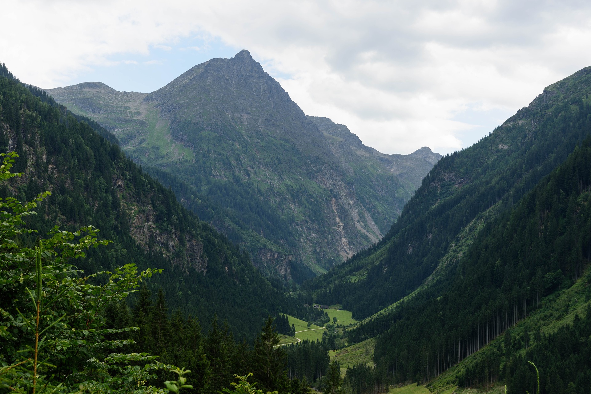
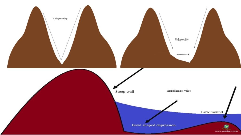
Rivers normally form narrow V-shaped valleys. As rocks fall into these channels and are dragged along, the channels widen to form U-shaped valleys.

Amphitheater valleys
One characteristic feature of volcanic islands is the presence of amphitheater valleys, commonly known as cirques. One side of the valley is high and dips into the ground; it then rises smoothly to form a low lying dune on the other side. This results in a bowl-shaped depression in the center. Cirques also occur on continental land during the thawing action of melting glaciers.
Amphitheater valleys are typical characteristics of dome-shaped volcanoes having a slope of more than 7° with dipping resistant and nonresistant rock beds [1]. In the case of tropical islands, high temperatures and humidity encourage the formation of the basins. Networks of streams arising from these valleys eventually shape them as the water carry away weathered materials. In Mauritius, the high amount of torrential rain during cyclonic conditions has developed a beautiful system of gorges and valleys.
Formation of amphitheater valleys
Amphitheater valley formation is enhanced by the cumulative processes of weathering and erosion. The outflow of groundwater from springs over long periods of time contributes to the head-ward formation of deep valleys as water acts on the slopes and gradually increases its surface area. The permeability of the underlying rocks is also very important; the more permeable the rocks are, the deeper the valley becomes. From there on, a dendritic system of stream arises along the spring’s main course until it reaches the sea or a lake. In Mauritius, such spring bursts and streamflow can be observed at Creve Coeur and Vallée des Prȇtes.
Amphitheater valleys in Hawaii
Maui: Case study
Volcanic erosion and valley formation has been well documented on the islands of Hawai’i. On the mature island of Maui, head-ward erosion along spring lines, outburst of streams and dyke formation has eroded much of the volcanic shield resulting in a more developed topography. It has been noted that on the northward and eastern side where the amount of rainfall is higher, valley cutting has been more defined as compared to the more sheltered sides. Amphitheater valleys with hanging waterfalls and back wall springs are common on Maui. The Kaupo valley, for instance, has a narrow mouth and a wide amphitheater valley at its head resembling a giant tadpole.
Amphitheater valleys on Mars
The presence of an intricate and obvious network of valleys on planet Mars is quite intriguing. It is hypothesized that these valleys have been formed by groundwater sapping and seepage erosion. Though presently there is no evidence of running water (speculation on frozen groundwater) on the planet, there is nonetheless a vast network of valleys that look like those on Earth. The Nirgal Vallis, the longest river on the planet, ends in amphitheater valleys that look like cirques on Earth.
The main valleys of Mauritius [2]
Between the mountains of Moka,
- Vallée du Pouce
- Vallée des Prȇtes
- Vallée du Pieter Both
- La Nicolière aux Pamplemousses
Between the mountains of Rivière Noire,
- Grandes Gorges
- Cȏte au Papin
- Vallée du Morne
Between the mountains of Grand Port
- Cent Gaulettes
- Plaine des Hollandais
- Les Bambous
- Vallée de l’Anse Jonchée
References:
- Saddul, P. (2002). Mauritius, A Geomorphological Analysis. Moka, Mauritius: MGI, pp 108-110
- B. de Burgh Edwards. (1921). Géographie Illustrée de l’ile Maurice. Port Louis, Mauritius: The General Printing and Stationery OY.Ltd, pp 12

Pingback: Sustainable tourism in Mauritius - Yo Nature
Pingback: Sustainable tourism in Mauritius - Yo Nature
Pingback: The rivers of Mauritius - Yo Nature
Pingback: Flooding: Types, Dangers and Mitigation Measures - Yo Nature