Tsunamis Explained: Types, Causes and Examples

Tsunamis are natural events that are highly underrated. Generally, they occur due to various reasons like earthquakes. These hazards can be quite devastating as they can have repercussions far from the coastline. In fact, it was the 2004 Indian Ocean tsunami event that raised the alarm bell on the dangers that tsunamis pose. During that catastrophic episode, more than 230,000 people died and many coastal cities were severely affected within hours.
Today, approximately 10% of the global population is living along the world’s coasts. By 2100, this will reach close to 600 million coastal inhabitants. Consequently, understanding and predicting tsunamis have become more important than ever.
Tsunami alertness
Before 1990, people primarily perceived tsunamis as originating from underwater earthquakes. This was especially true in the Pacific Ocean where tsunamis often occur.
In the 1990s, 14 tsunami events took place as near coastal events with little warning to local inhabitants. At that point in time, scientists realized how dangerous these events could be. While other hazards caused more damage and deaths then, tsunamis were pervasive in nature.
Nevertheless, the 2004 tsunami event in the Indian Ocean was the real eye-opener. It started from Indonesia and swept across the northern Indian Ocean within hours. Tsunami waves hit the coast of Australia, Arabia and West Africa as well as the low-lying Maldives atolls. Consequently, the widespread devastation of the tsunami heightened alert in researchers, governments and the public.
What is a tsunami?
Basically, a tsunami is a wave or a series of waves that are generated by the sudden, vertical displacement of water. Tsunami is a Japanese word that means harbour (tsu) and wave (name). This is because underwater earthquakes often trigger violent waves that reverberate in harbours.
As it is, tsunamis can be quite destructive as they can travel over large areas across the ocean. In this way, they can have impacts far from the point of origin. At times they can displace water over a few kilometres, at other times it can be as much as 1,000 km.
What happens during a tsunami?
So, the tsunami waves propagate in the ocean. In general, a tsunami travels at a speed related to its water depth. It can even reach up to 900 km per hour with less than 1 m waves.
As a general rule, the energy flux of the tsunami depends on both the speed of the waves and their heights. Basically, the energy flux remains constant throughout the event. Eventually, the tsunami slows as the water depth decreases. Hence on nearing land, its speed can reach 45 km per hour. However, as the speed of the tsunami decreases, its height grows. This effect is called shoaling.
Thus, most of the times, tsunamis are unnoticeable at sea until they reach the coasts. Depending on the bathymetry of the coast, the tsunami can also take the form of breaking waves.
Tsunami waves can be as much as tens of meters to hundreds of meters high. To date, the highest tsunami wave recorded was off the coast of Alaska in 1958. It measured 525 m (1720 feet) and was caused by an earthquake.
Classification of tsunamis
Moreover, there are three types of tsunamis based on the scene of the disaster: local, regional and remote.
Local tsunamis
Local tsunamis as the name says has local impacts. Here, tsunami waves can reach up to 100 km from the source of origin in less than one hour.
Regional tsunamis
Regarding regional tsunamis, they affect regions within 100 km to 1,000 km away from the source of origin. In general, they take 1 to 3 hours to do so.
Remote tsunamis
As for remote tsunamis, they typically affect regions more than 1,000 km away from the point of tsunami origin. Thus, they usually take over 3 hours to strike coasts.
What causes a tsunami?
Though in the past we related tsunamis as mostly arising from submarine earthquakes, today we have better knowledge on the matter. Therefore, we now know that several submarine and terrestrial events cause tsunamis. These include earthquakes, volcanic eruptions, landslides and asteroid impacts.
Earthquakes
One of the leading causes of tsunamis on Earth is indeed due to earthquakes. Underwater earthquakes especially can lead to tsunamis by causing the seafloor to move. Alternatively, earthquakes can also trigger landslides. Nonetheless, seafloor movement is the most common reason. But, generally, it takes an earthquake equal to or more than 7.5 in magnitude to initiate damaging tsunamis.
So, seafloor movement occurs as one tectonic plate goes under another one during subduction. When this happens, earthquake vibrations displace the ocean water above these plates. Consequently, water moves vertically and disturbs the ocean’s surface resulting in tsunami waves.
As it happens, the devastating 2011 Tohoku Tsunami in Japan was initiated by a 9.1 magnitude earthquake. Waves up to 9 m high (30 feet) devastated the coastline of Japan from buildings to highways and killed more than 20,000 people.
Volcanic eruptions
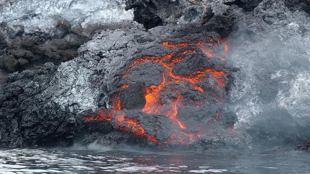
Additionally, volcanic eruptions, be it on land or underwater, can generate considerable tsunami waves. These eruptions can be quite deadly and can spread rapidly around the world.
As it happens, both underwater and terrestrial volcanoes can typically propel large amounts of materials into seawater. Ultimately, these materials can cause the water to rapidly disperse.
Likewise, volcanoes can cause the seafloor to shake in the form of an earthquake thus generating tsunamis. What’s more, volcanic calderas whether submarine or as islands, can also collapse and displace water.

One of the deadliest tsunamis that ever occurred was due to the 1883 Krakatoa volcanic eruption. It occurred in the Sunda Strait between Java and Sumatra and led to tsunami waves up to 40 m tall. More than 36,000 people died and explosions were heard as far as Australia.
Landslides
Submarine landslides are actually widespread on submarine slopes. In essence, sediment and rock break off from these slopes and tumble into the deep ocean. These submarine landslides occur due to the natural weathering process. Sometimes, human activities like dredging can also initiate them as well as hazards like earthquakes and volcanic eruptions.
Consequently, when a huge mass of sediment and rockfall onto the seafloor, it displaces the water vertically. As a result, tsunami waves form.
Also, landslides from the land can cause tsunamis just the same if they occur near cliffs and coasts. Thus, when materials crash into the ocean, they can displace large volumes of water. This displacement subsequently leads to tsunami waves.
As a matter of fact, the 1958 tsunami event in Alaska occurred due to a landslide. A 7.7 magnitude earthquake actually set the landslide in motion. Sustained earthquake vibrations caused some 30.5 million cubic meters of rock to fall into the Lituya Bay. Due to this, a tremendous amount of seawater displaced reaching heights up to 525 m.
Asteroid impacts
Today, thanks to advances in marine science, the evidence of asteroid impacts in our oceans are well documented.
Perhaps the most common asteroid impact in the sea is the Chicxulub impactor. This large asteroid about 10 km in diameter struck the shallow sea near Chicxulub, Mexico some 65 million years ago. It subsequently formed the Chicxulub crater now buried under the Yucatan Peninsula. Following the impact of the asteroid on Earth, mass extinction of biodiversity occurred including that of the dinosaurs.
Also, in many aseismic regions of the world like Australia and eastern Scotland, there is geological evidence of tsunamis. Researchers contend that asteroid impacts most likely initiated these tsunamis.
Thus, without a doubt, asteroid impacts can generate cataclysmic tsunamis. Scientists propound that an asteroid 5-6 km in diameter would wash out coastal places on either side of an oceanic basin.
Measuring tsunamis
In order to detect tsunamis, scientists use tide gauges, deep-ocean buoys and satellite altimetry.
Deep ocean buoys
Deep ocean tsunami buoys are gadgets that monitor tsunami waves. The system consists of a sensor that lies on the seafloor and a floating buoy that transmits the data to the tsunami centre. Deep ocean buoys typically measure changes in water heights.
Tide gauges
Tide gauges are instruments that have been historically used in sea level monitoring. Basically, it is a small pipe through which seawater circulates. Sensors measure the height of the sea and transmit the information to monitoring centres. Since sea level rises during a tsunami, sea level slopes can be detected with tide gauges.
Satellite altimetry
Altimeters found on satellites can detect tsunamis and measure the heights of the waves. The 2004 Indian Ocean tsunami waves were detected and measured by altimeters onboard various satellites. As a result, this episode served as the basis to initiate research in the use of satellites to detect tsunamis.
Nowadays, various tools like simulation software and GIS can be coupled to satellite information to warn people of the menace of upcoming tsunamis.
Where do tsunamis generally occur?
Most of the world’s tsunamis occur in the Pacific Ring of Fire or the Circum-Pacific Belt. Here, the Pacific Belt meets various tectonic plates. Consequently, volcanic eruptions and earthquakes frequently occur as the plates move thus leading to tsunamis.
Indonesia, Japan, New Guinea, Philippines, New Zealand are some of the countries that occur along the Pacific Belt. For that reason, tsunamis often affect them.

References
- Carusi, A., Perozzi, E. and Scholl, H., 2005. The Near Earth Objects: Possible Impactors of the Earth. Mitigation Strategy.
- Dengler, L., 2002. “Tsunami: The Underrated Hazard” by Edward Bryant. Seismological Research Letters, 73(1), pp.93-94.
- Keller, E. and DeVecchio, D., 2015. Natural hazards: earth’s processes as hazards, disasters, and catastrophes. Pearson Higher Education AU.

Pingback: Volcanic Eruptions: Positive and Negative Effects - Yo Nature
Pingback: Flooding Explained: Types, Causes and Examples - Yo Nature
Pingback: Climate change: Natural and Anthropogenic causes - Yo Nature
Pingback: Effects of tsunamis: Positive, Negative, Examples - Yo Nature